

rox
Content Type
Profiles
Forums
Downloads
Gallery
Events
Articles
Posts posted by rox
-
-
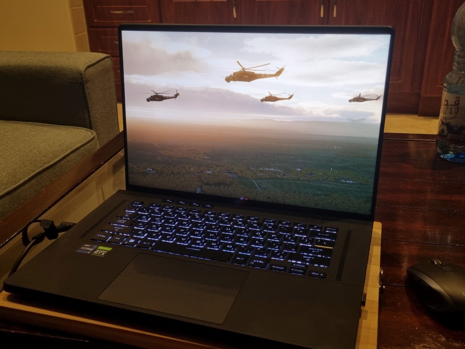
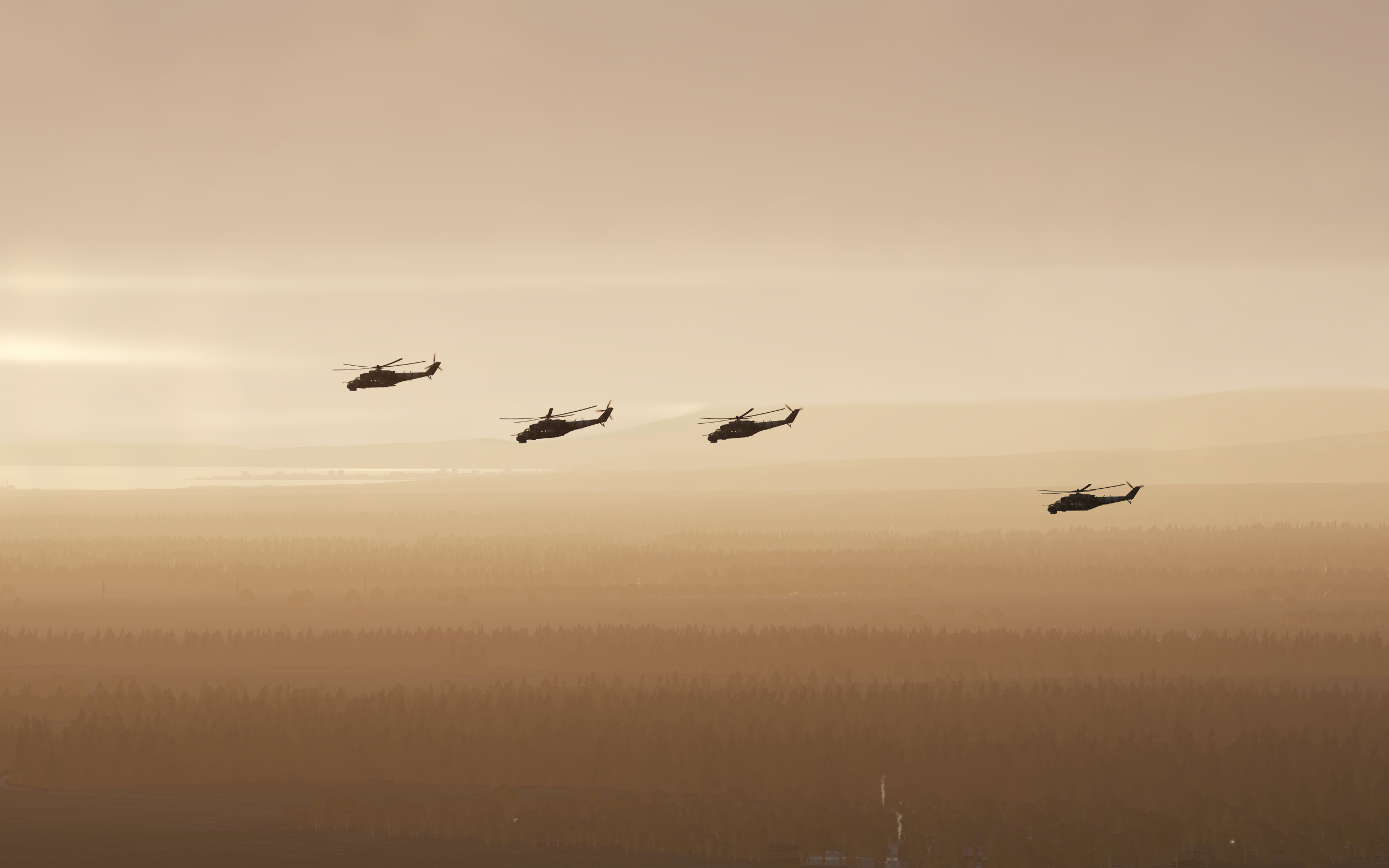
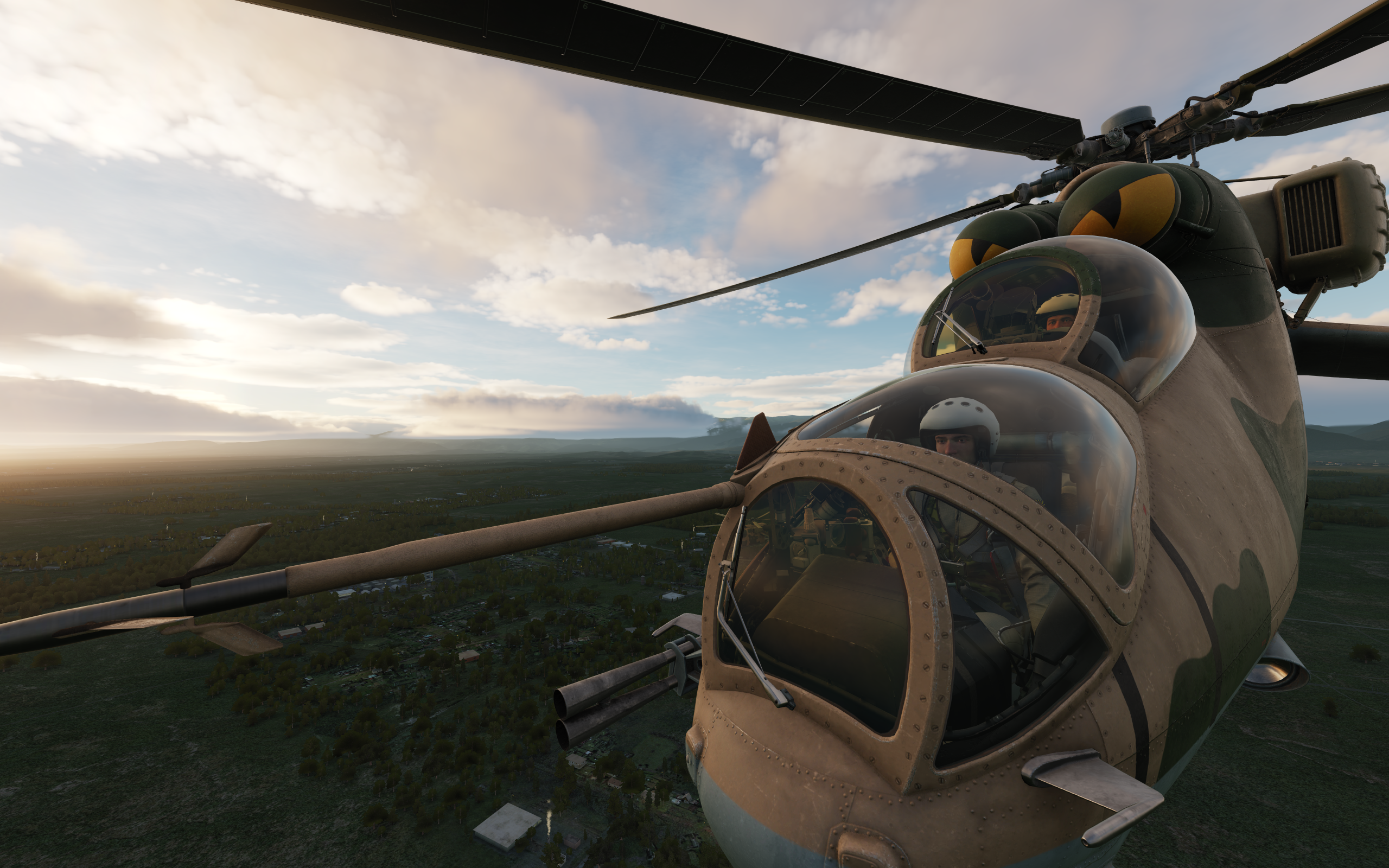
Nice to see that those three polygons that are supposed to look like a Black Hawk are getting a more realistic sound

-
That's pretty insane. These satellite valleys make Caucasus look like windshield bug splatter. The way these rock features on mountain tops and faces are so well modelled and drop shadows is amazing. Did they use some kind of software that detects satellite photo detail beyond just map elevation data and turned that detail into normal maps or how tf was that achieved?
-
Thanks Tom, can't wait to land into all of that kit.
-
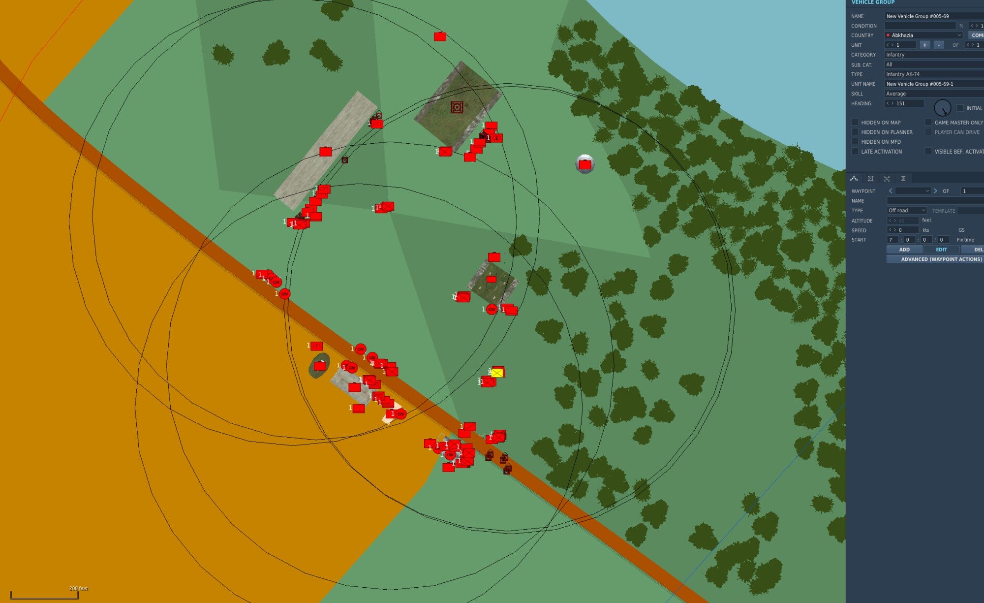
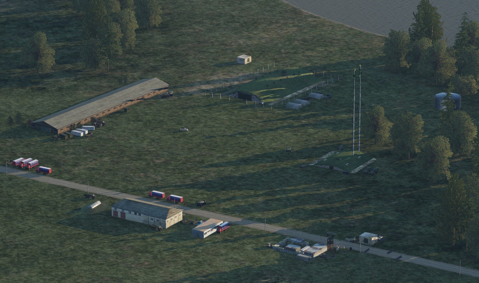
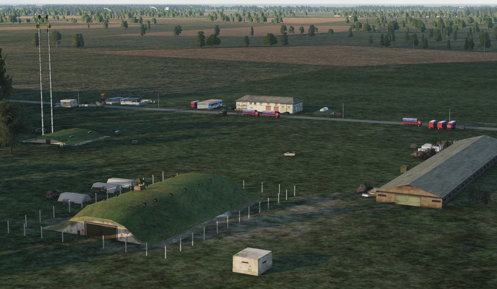
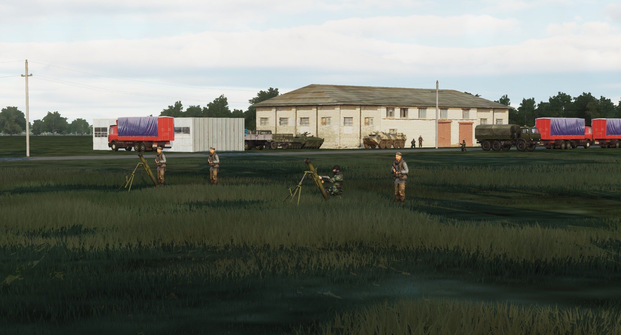
Since I have no idea about AI impact on server performance, is this overkill or ok? There are around 40 AI vehicles and infantry here, plus a bunch of static objects.
If that's too much, I can turn most of these unarmed vehicles into static objects and cut down on the infantry.
If the server eats this for breakfast then I might also want to add an outpost (smaller than this, and a bit more dangerous) in the mountains north of the dam.

-
Thanks, and don't worry!
*adds 20 US and Russian carrier fleets next to each other*
-
 2
2
-
-
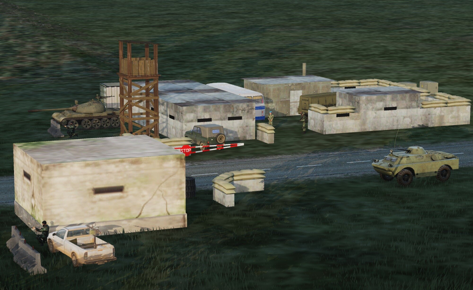
Something that was mentioned when we were doing heli action yesterday is that we would need a proper area with mostly soft targets that helis stand a chance against. Some kind of insurgent compound with no SAMs, MANPADS, vehicles with ATGMs or 23 mil AA guns (not sure if there's a difference in accuracy of manually aimed and radar assisted AA guns in DCS), but with trucks, cars, the odd IFV, APC or tank, some buildings and insurgent infantry.
Since I know Tom is often busy, I can easily fix something like that up in the mission editor if I'm sent the mission file (I assume/hope it's not huge). I'd just place the units somewhere reasonable from the FARP and not touch anything else.
-
 1
1
-
 1
1
-
-
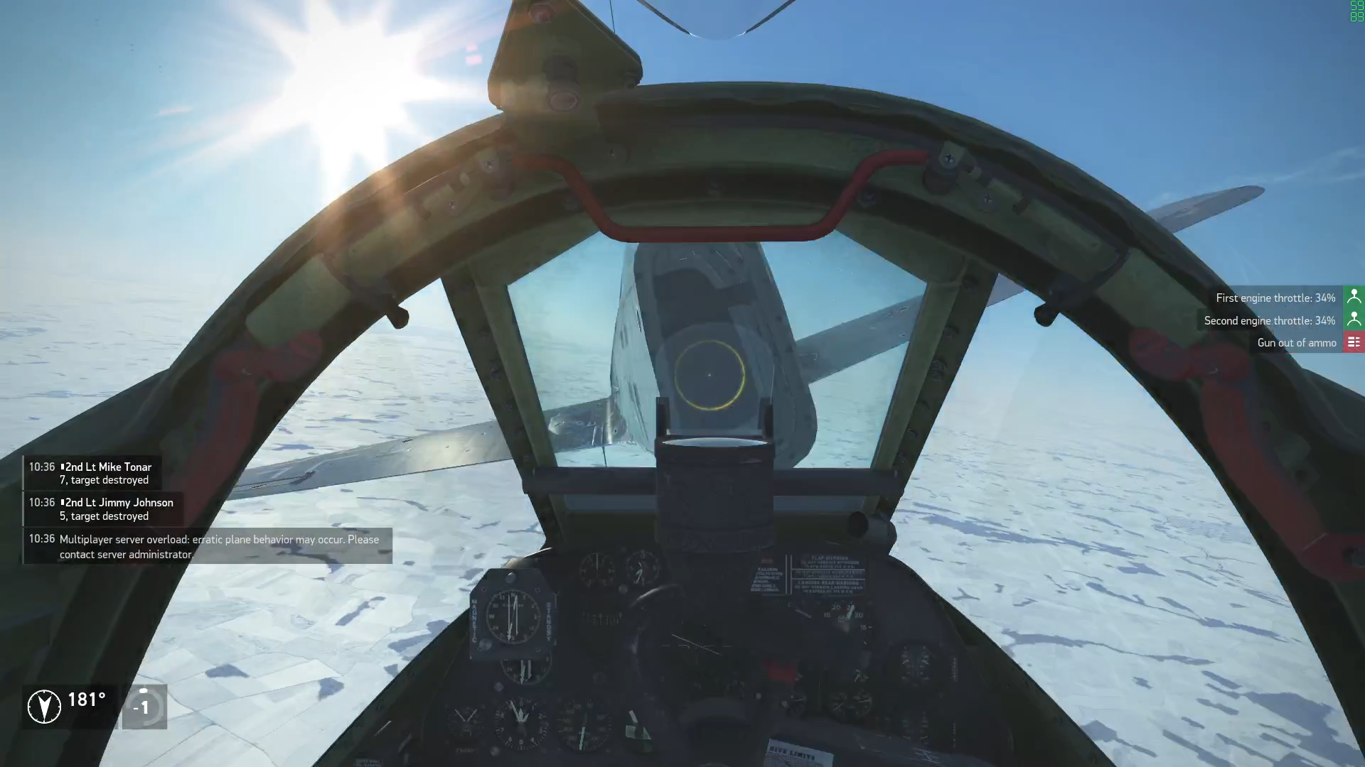
He forgot some other gems joys such as the engine compressor stalling or flaming out just after you finally manage to almost lock something, or if you dare to turn too much with someone on your 6. The landings which are as easy as landing the Mi-24 at 340kph. The quantum dynamics-inspired weapon selection panel. The 37 G roll-rate. The gear lowering mechanism dying if you forget to set the lever to neutral. The gun that fits two rounds of ammo. The radar that works for only 40 minutes (or was it 20?) because that's the time it takes for the pilot to drink all the alcohol coolant, because the last thing you want in the Mig-21 is to be sober.
-
1
-
-
Some of you may know that I hiked quite a bit in Georgia on a few occasions, most won't know that I spent four weeks in the mountains last summer and will do so again this summer.
Here's a comparison of some picturesque mountain views in real life against their DCS counterparts. Some are somewhat impressive, others.....nnnnot so much.
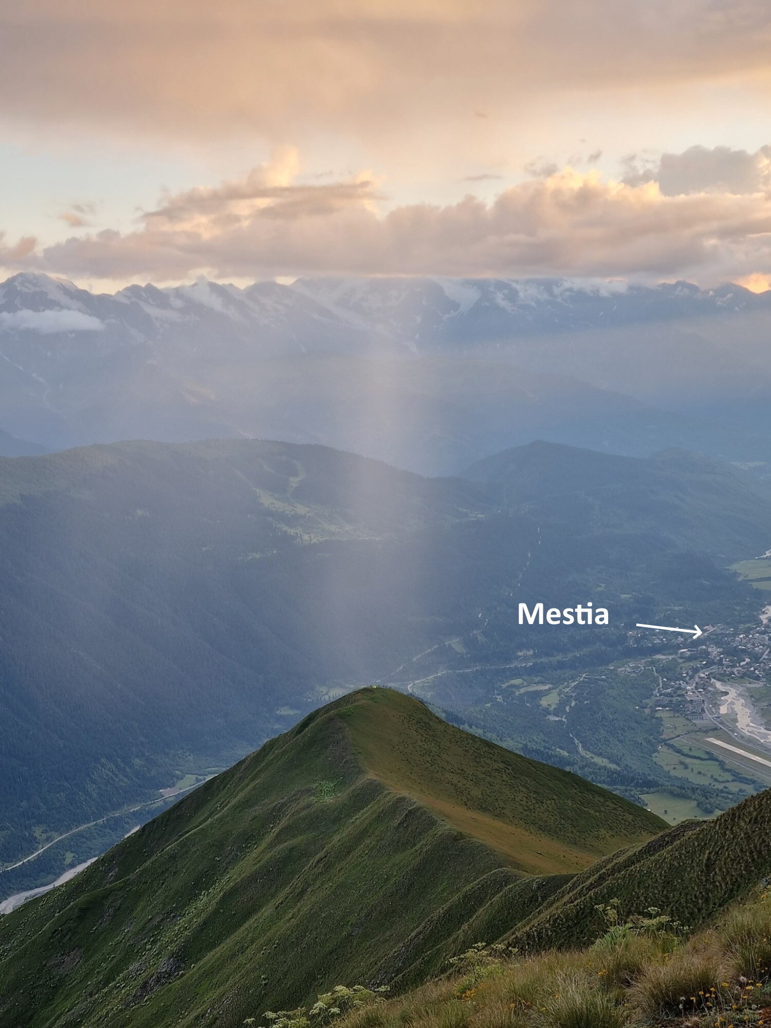
Most of these are from the region Svaneti, around Mestia and Usghuli (Mestia is where the Enguri river leads if you follow it upstream of the dam through the valley). Some are from Kazbegi, which is on the main road to Russia just north of Tbilisi.
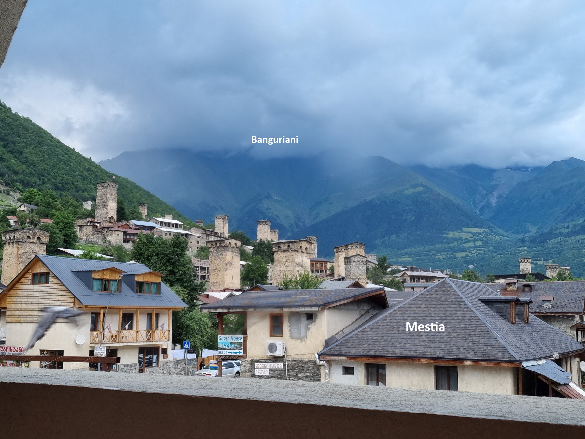
Let's start with Mestia, the largest town/village in Svaneti.
Hotel view
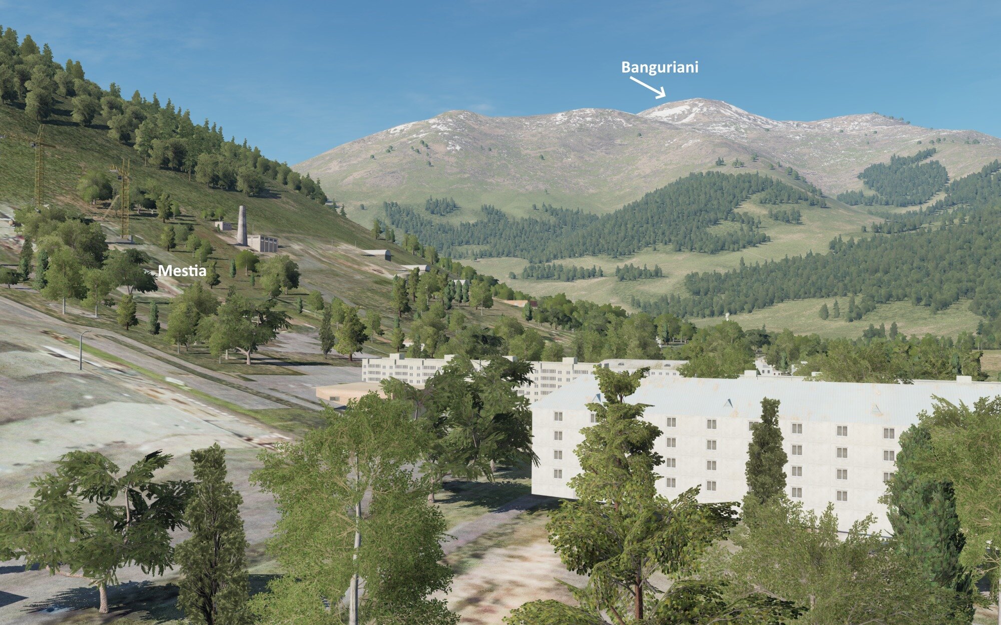
DCS version. This is the most underwhelming one, it gets a bit better
. At some point after half a bottle of wine I actually thought the chimneys were modelled Svan towers that you see in the photo.
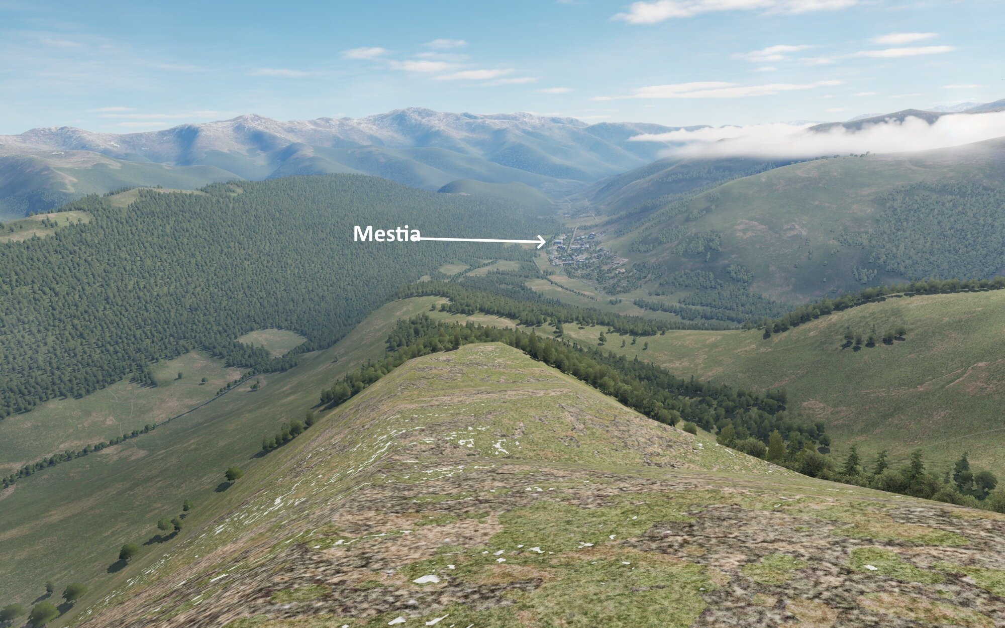
Here's Mestia from Chkhuti ridge. The green dot on the tip of the ridge is my tent with god shining his light down on it, wondering which idiot pitched a tent in the most suicidal spot on the mountain.
DCS version, my tent is disappointingly not modelled.
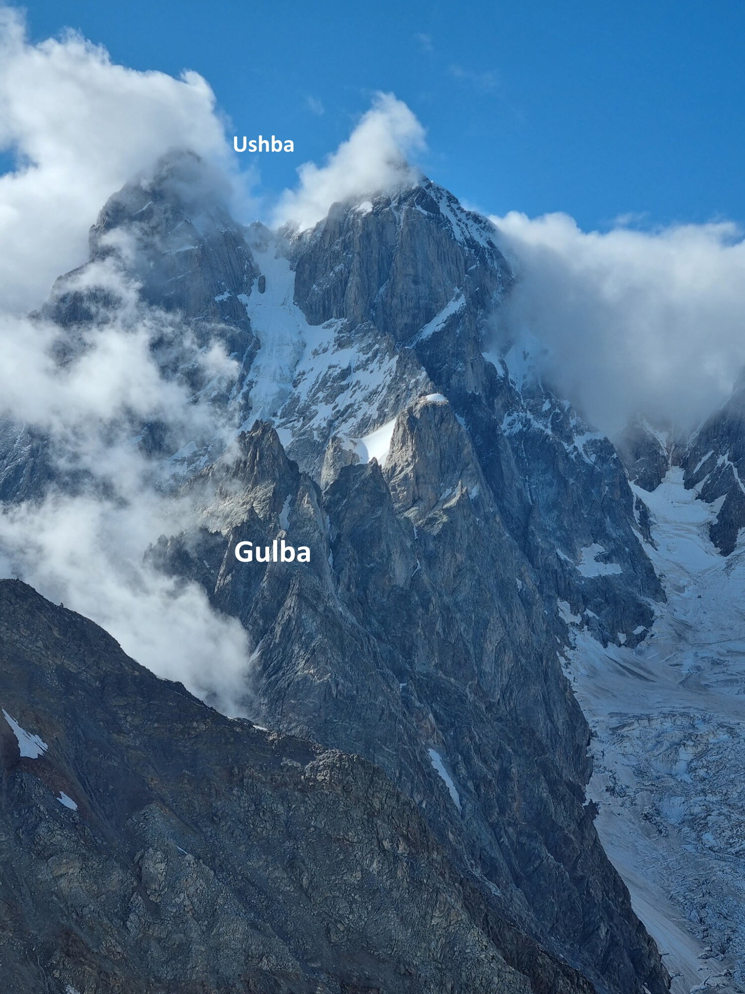
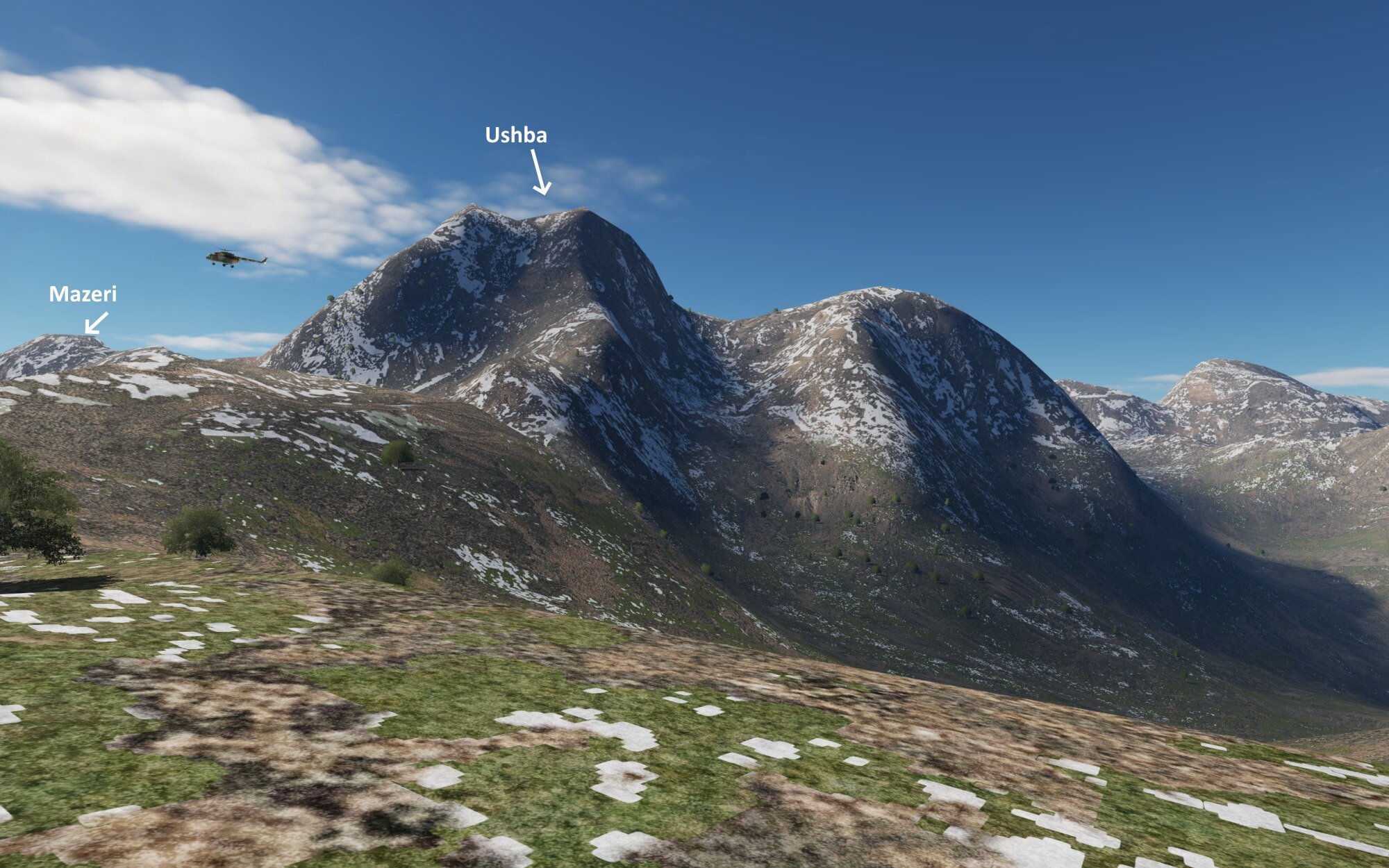
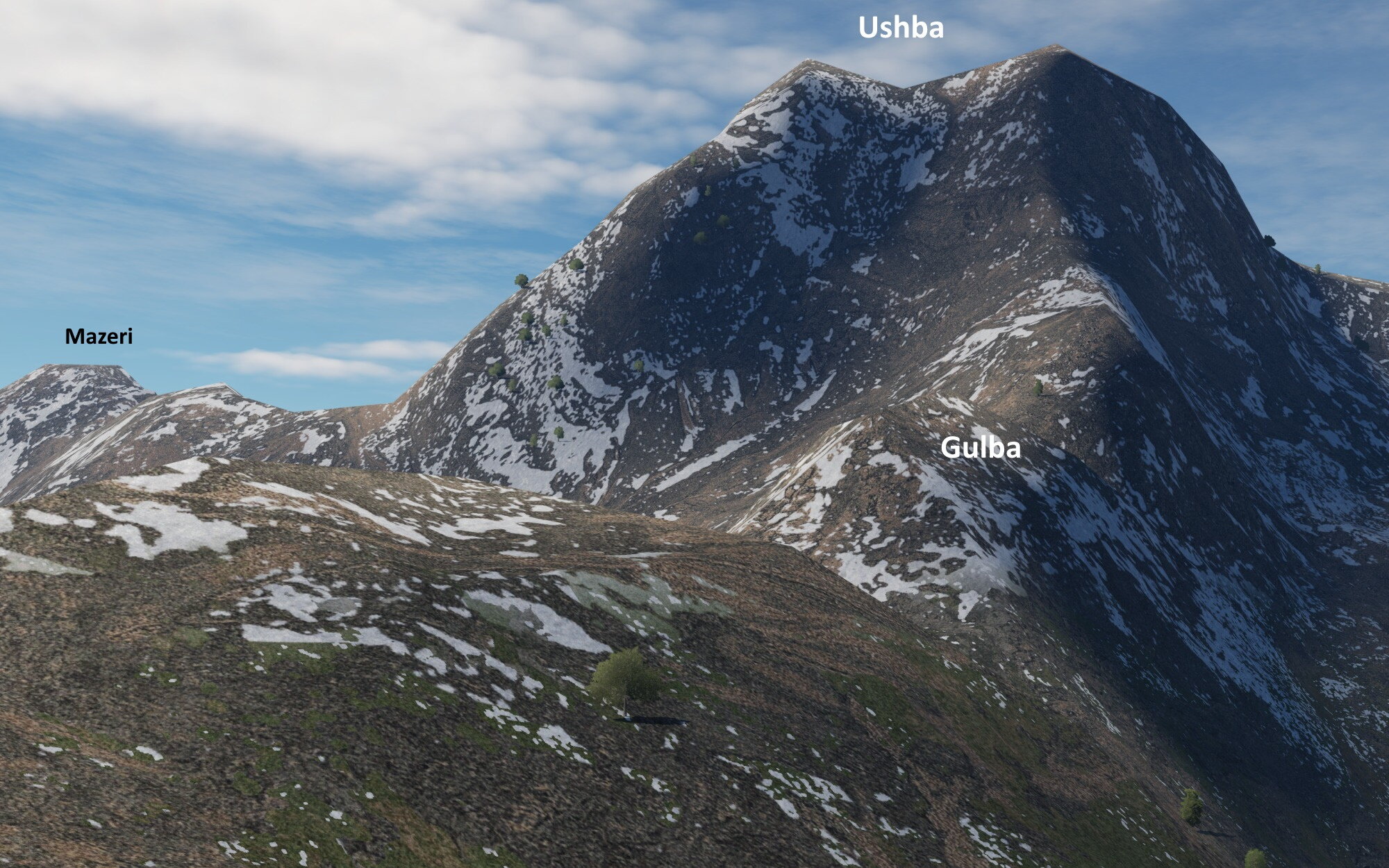
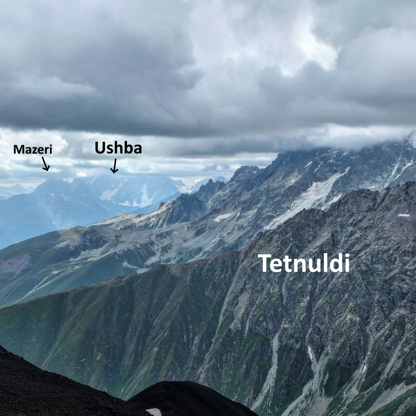
North of Mestia is one of Georgia's most legendary mountains and difficult and deadly climbs, the 4,700m twin peaks of Mount Ushba.
Here a closeup through a break in the clouds
Here obscured but surroundings visible
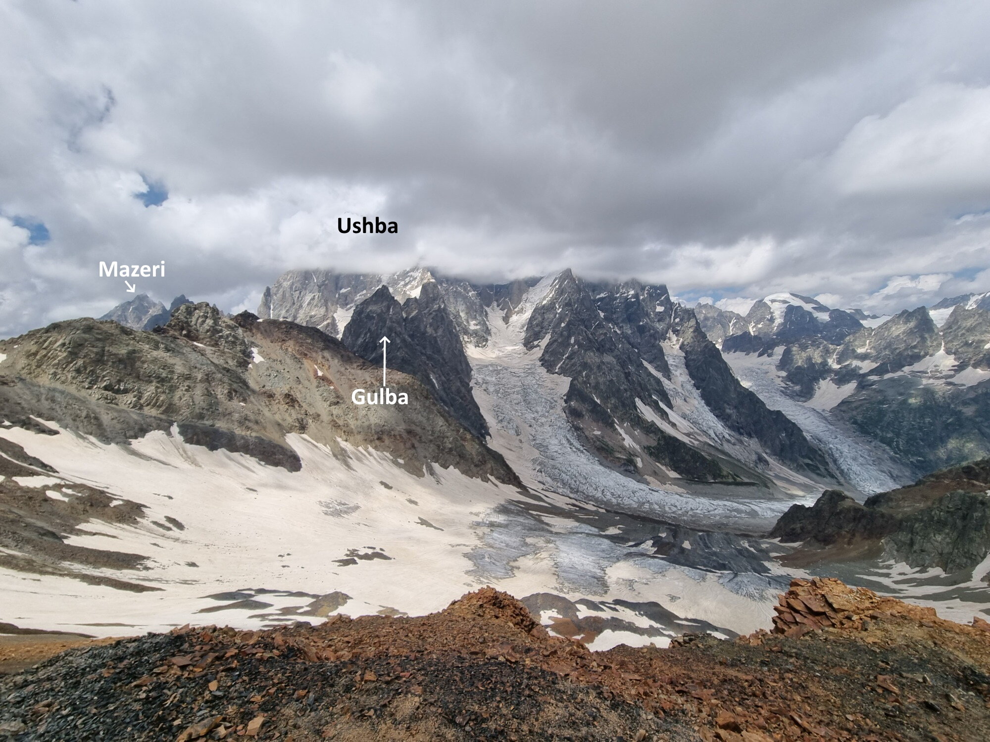
And DCS. The geography here is surprisingly accurate, including the glacier valley below, Mazeri peak (4000m) to the left, and there are even traces of Gulba, an eye-catching sub-peak of Ushba that almost looks like it's guarding her with its foreboding cliffs.
These trees certainly don't exist
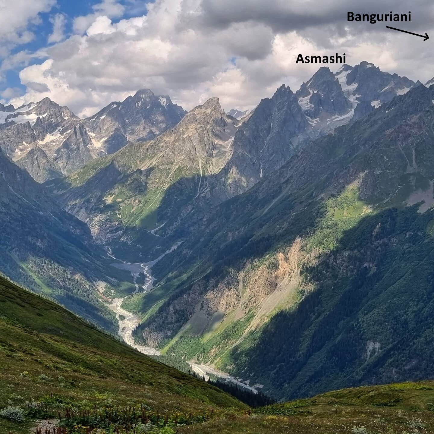
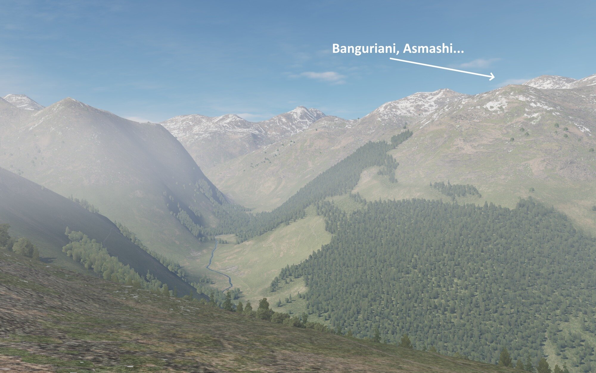
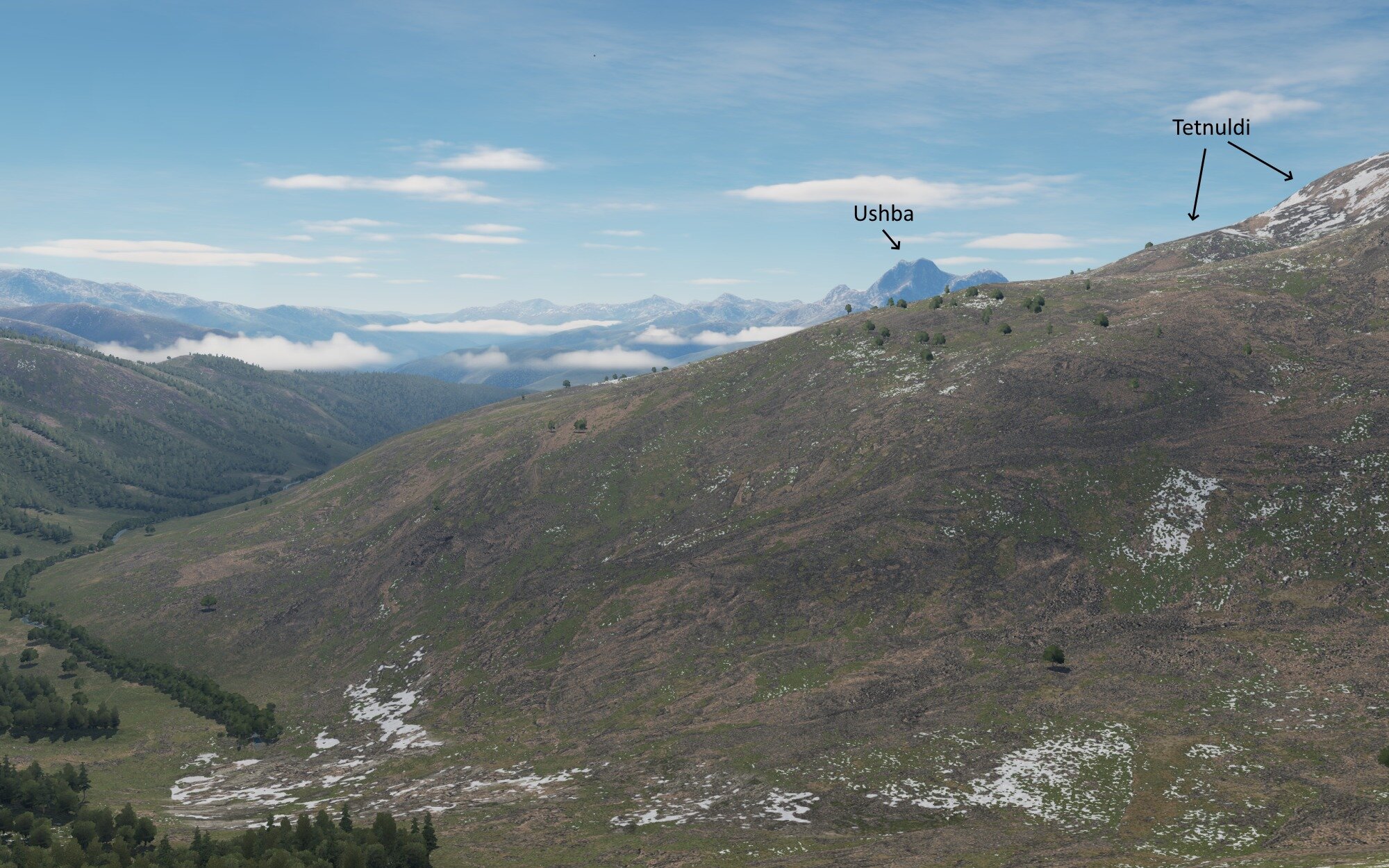
Nearby Ushba, this outrageous valley that terminates in the Mestia glacier
The mountains do kind of all line up, they just look like poo. Imagine if you could actually fly through the above in DCS.
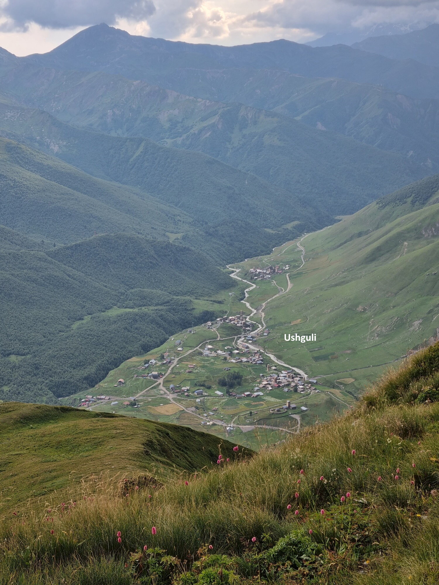
Moving on to the UNESCO village of Usghuli from a nearby small mountain
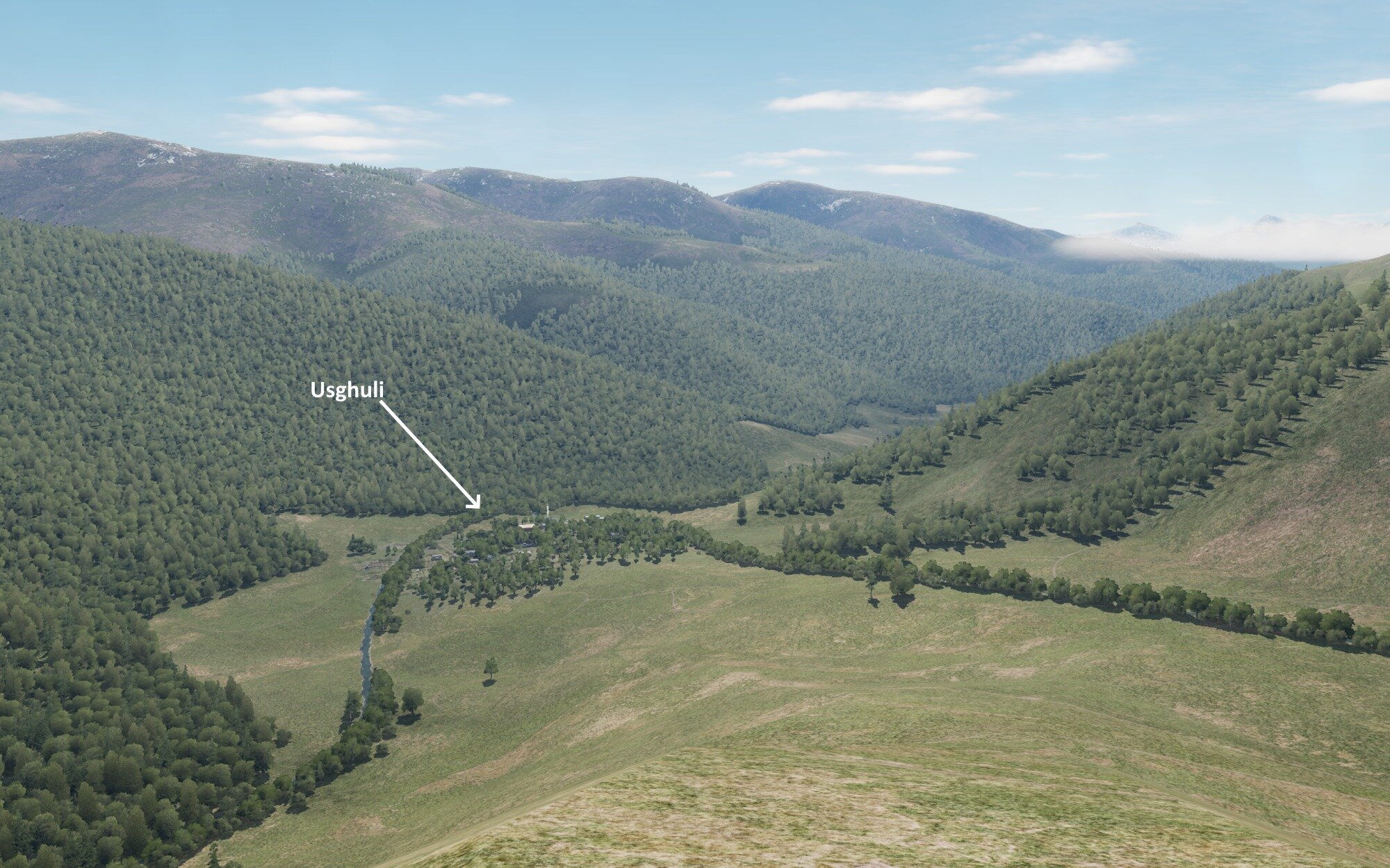
And DCS a little bit lower on the same mountain
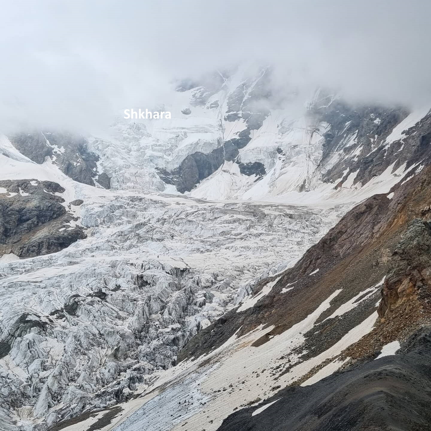
Shkhara Glacier from the nearby smaller mountain of Karetta. Shkhara is Georgia's tallest mountain, and the third tallest in the Caucasus
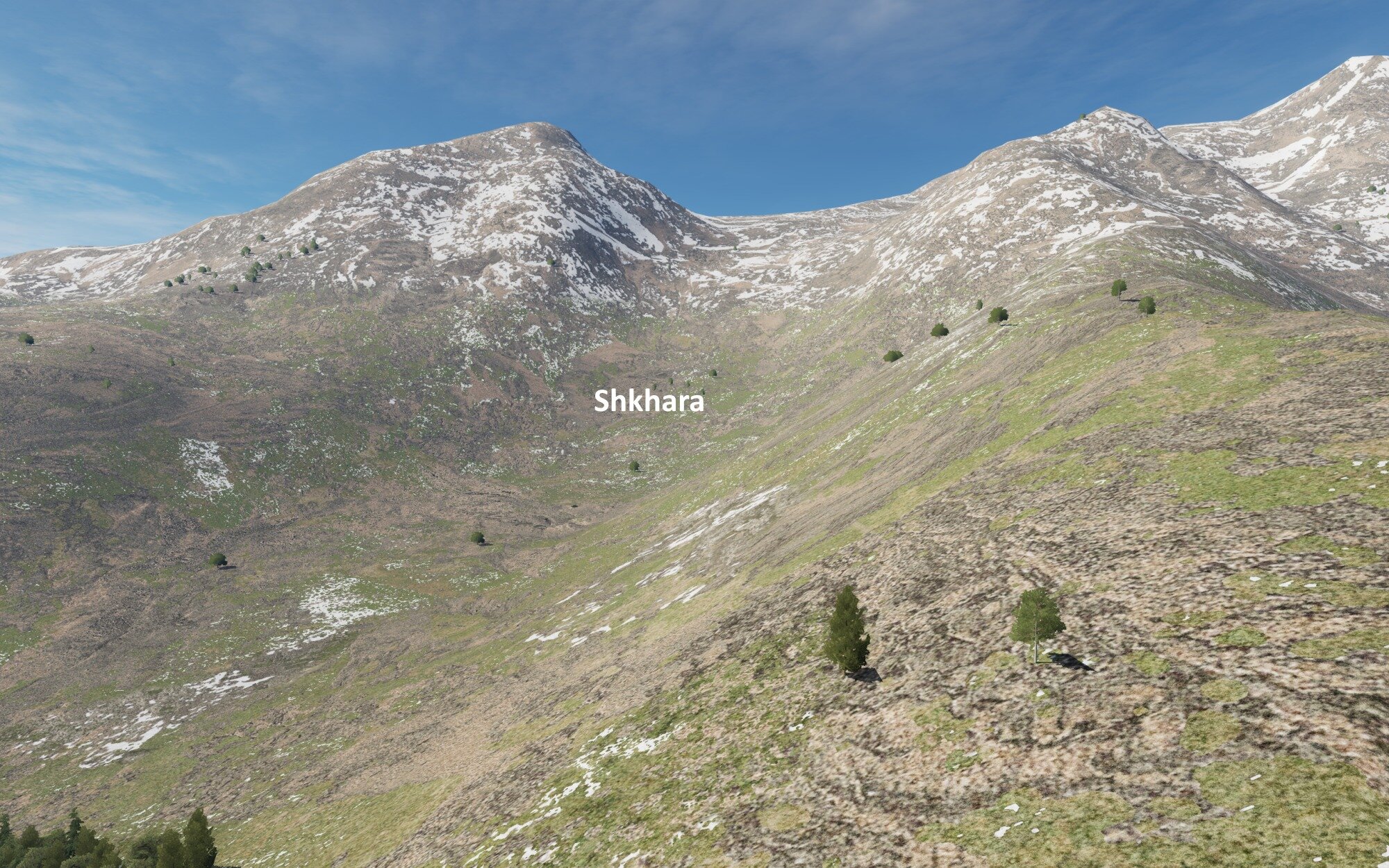
Meh. DCS needs glaciers. And realistic seasonal melting patterns and long-term glacier retreat. Can't fly comfortably with this game-breaking absence of realism.
The slopes of Tetnuldi (4500) from the same spot
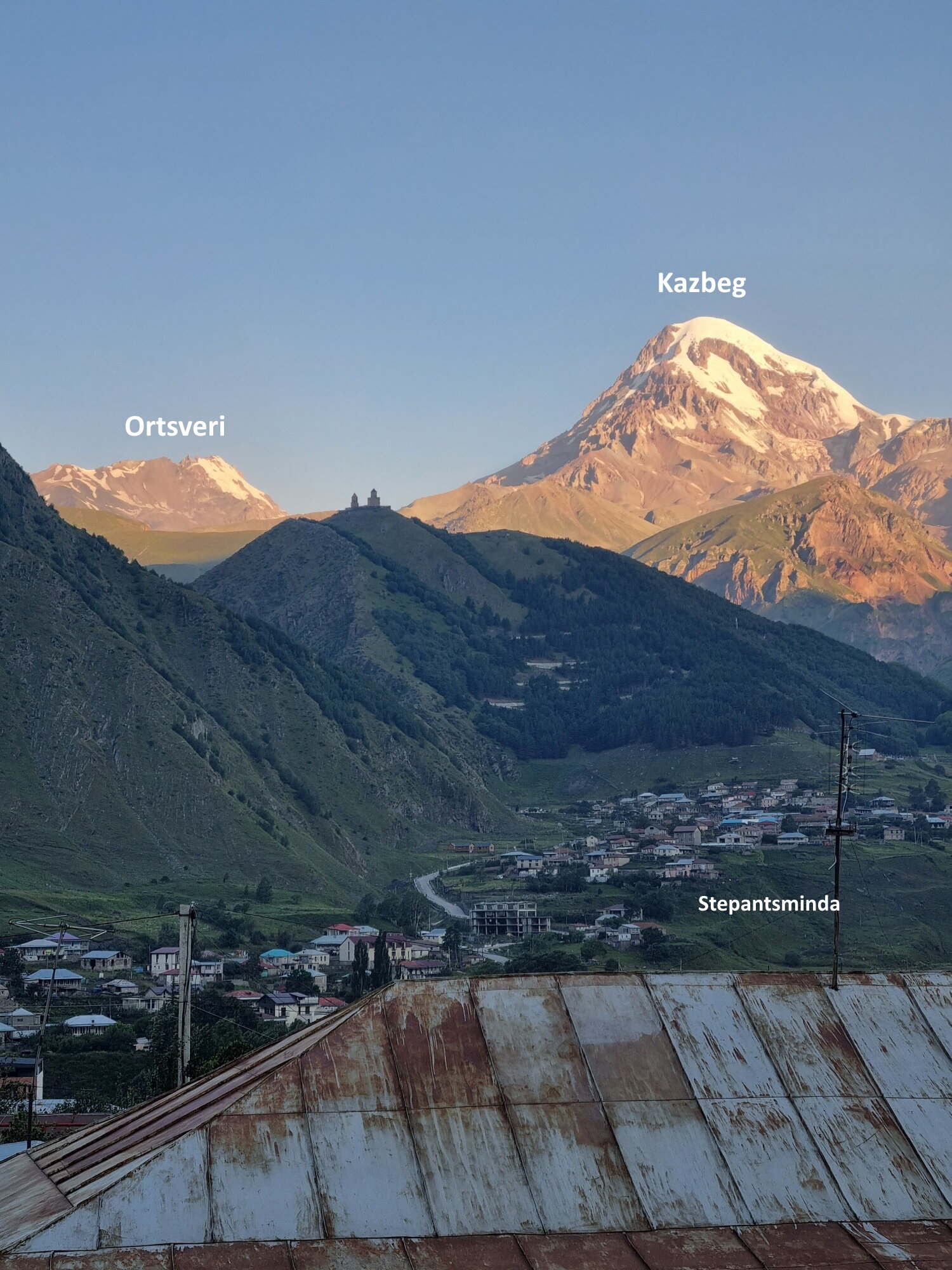
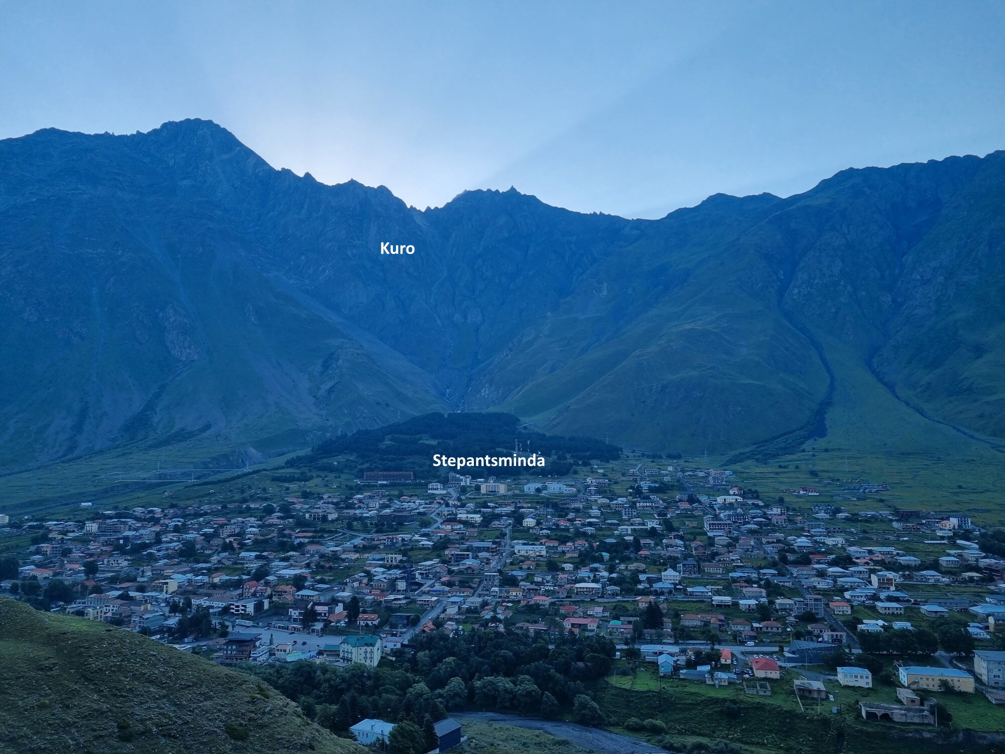
We're moving on to Kazbegi, where Kazbek, a prominent dormant stratovolcano towers over everything on this side of Georgia (and Russia). This is where the famous Trinity Church is that features on every other photo of Georgia ever. The town is also called Kazbegi although its official name is Stepantsminda.
Not good, not terrible, no church, hardly even its mountain. Stepantsminda is underwhelming, but considering what it looks like in real life, it's probably for the best.
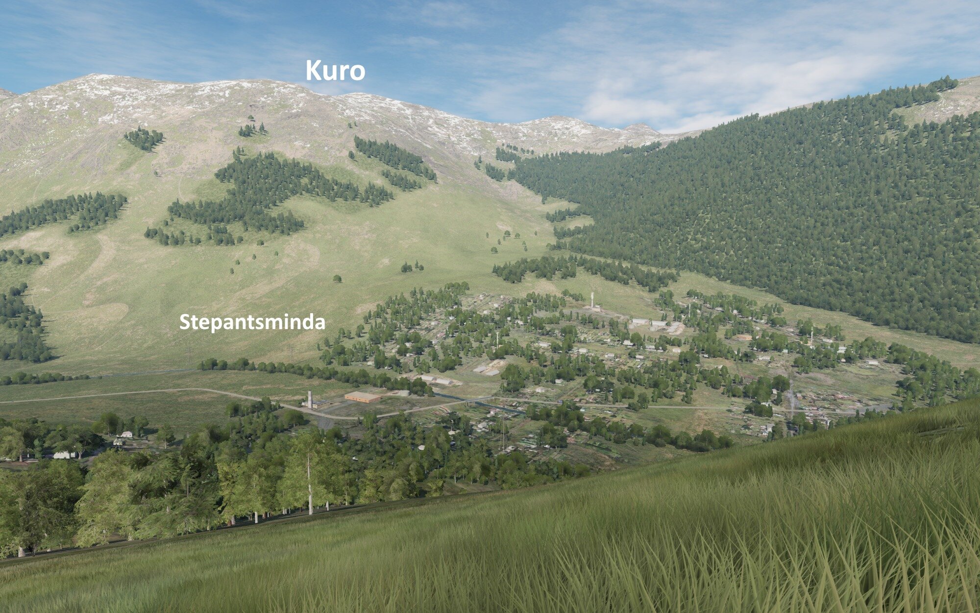
Stepantsminda looking the other way, towards Mt. Kuro which towers closely over it with its 4000m.
There are no forests, part of a slope far to the south/right is forested, but that's kilometers away.
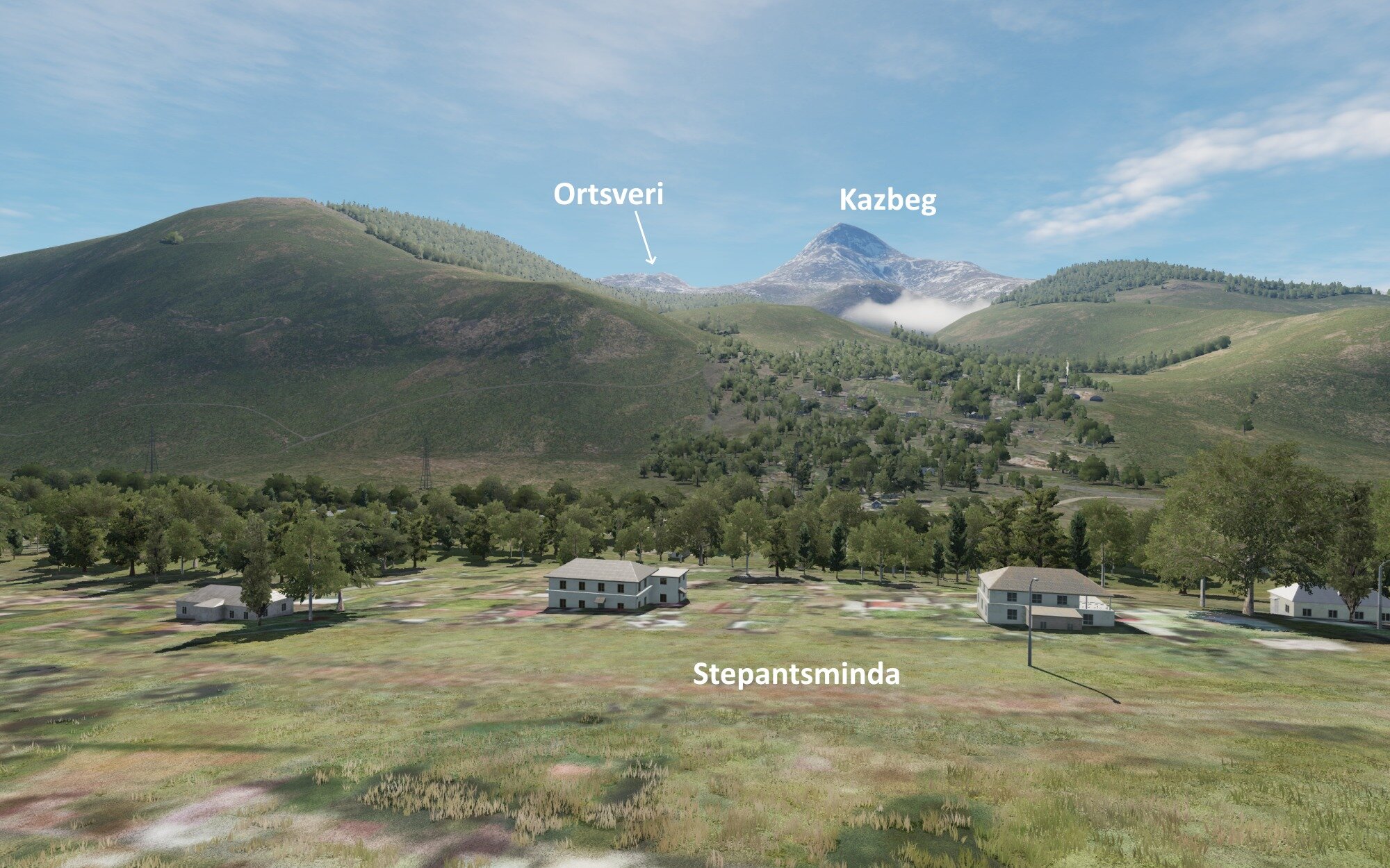
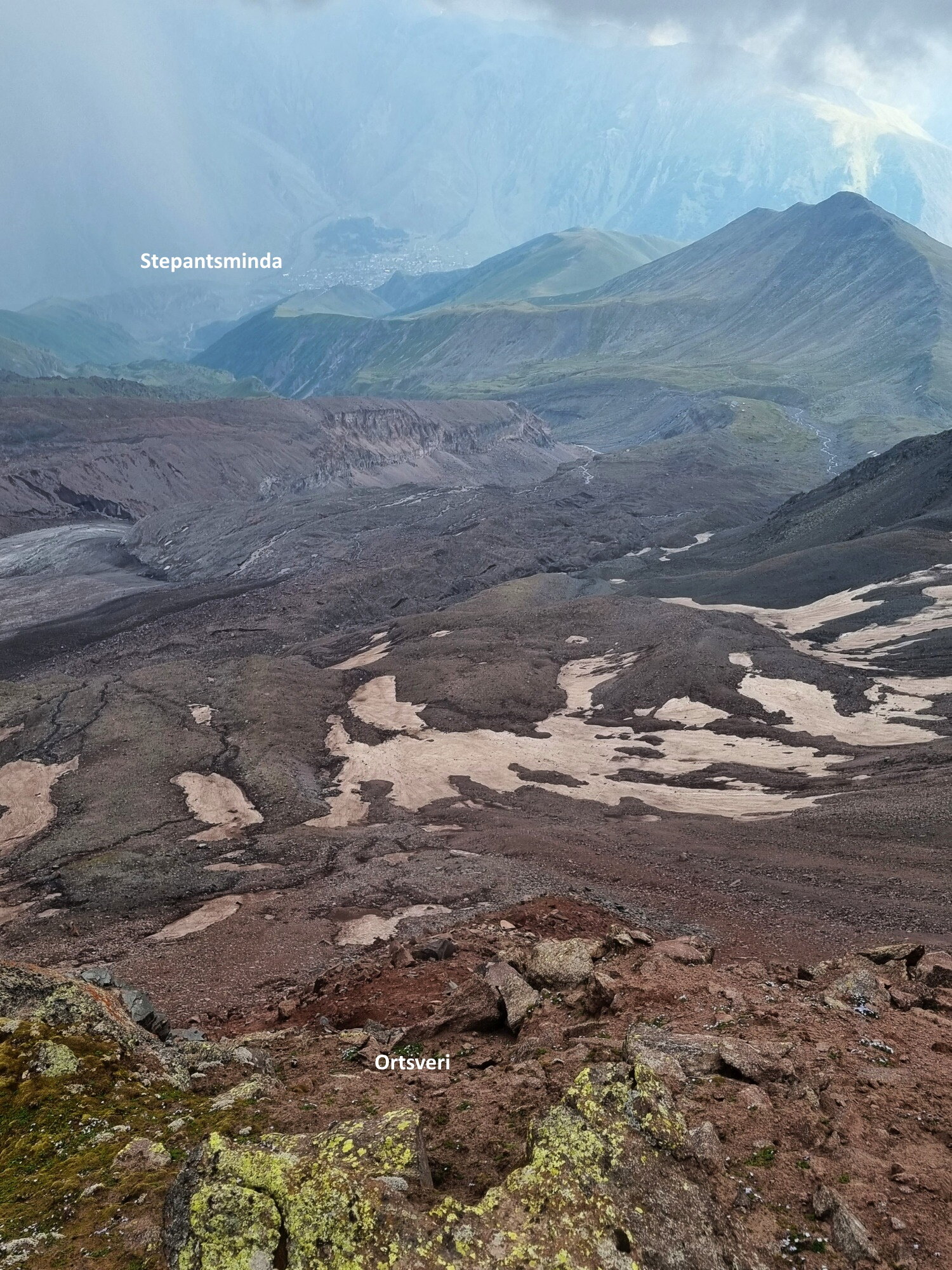
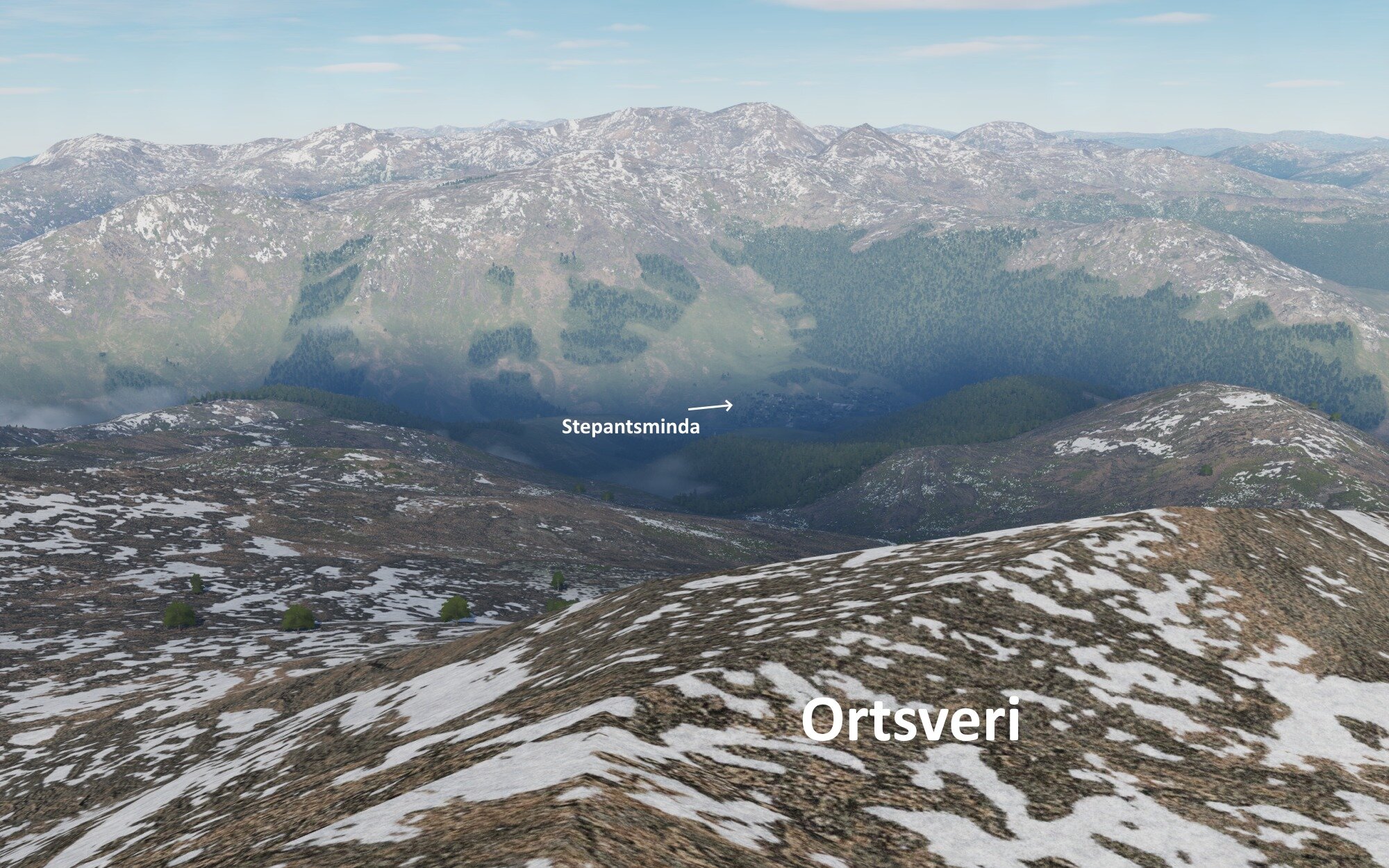
Looking down all the way to Stepantsminda from the slopes of Mount Ortsveri 20 kilometers away and 2200m higher.
Not bad geographically. You can see a wisp of the Gergeti glacier to the left on the photo above, obviously not featured in DCS.
That's it for now. Might have more in August. I'm taking requests! I tried to get the Enguri dam but you never actually get to see it from the road up the valley.
-
2
-
1
-
-
Certainly stronger than probably all the desktops I've ever owned combined
I'm just afraid it'll melt though.
-
1
-
-
So I may or may not have spent a shameful amount of money on a small black box that can run DCS 95% maxed out.
-
3
-
-
It certainly gives a new angle to Russia being hard to approve even 80's Soviet aircraft types that countries around it use.
-
On 2/28/2022 at 7:25 PM, BluBear said:
I'm not familiar with all the inner workings but, Isn't Eagle Dynamics Swiss-based?
Yeah no idea how it works either. I remember they had to get an OK from Russia for each aircraft of Russia's they'd develop as a module.
-
Any news or rumors on the future of DCS if the banking sanctions on Russia become the new normal?
-
Nearly intact Ka-52 brought down in Ukraine today. I hope they manage to ship that thing out of Ukraine ASAP (not that it's any cutting edge tech probably).
-
1
-
-
WTF kind of sound is that? Is that a new Harpoon sound?
-
I wanted to join for my last Lightning Strikes mission yesterday but I took a power nap at 6 PM, only the power nap was so powerful that it lasted until 4 AM.
In any case, thanks a lot to Fenrir for the last one year (?) of this campaign, and to everyone else who participated and made it what it is. We're probably the most skilled P-38 pilots in GBS after this lol (at least in strafing pinpoint targets
)
-
2
-
1
-
-
If I set my frame rate to 43.3 frames per second (2600 frames per minute), does that mean I get a static prop effect like in them helicopter videos? 🐶
-
-
Two minutes earlier...
-
1
-
 1
1
-
-
-
Sterilizing a dozen acres of land with the Su-27. Who needs self-targeting Harry Potter CBU-97s when you can just target everything. Also shallow dive strafing ffs! Not like I shouldn't have learned a lesson in the P-38 campaign, twice.
Not sure if that tyre burst had to do with deploying the airbrake while still fast on the runway.
-
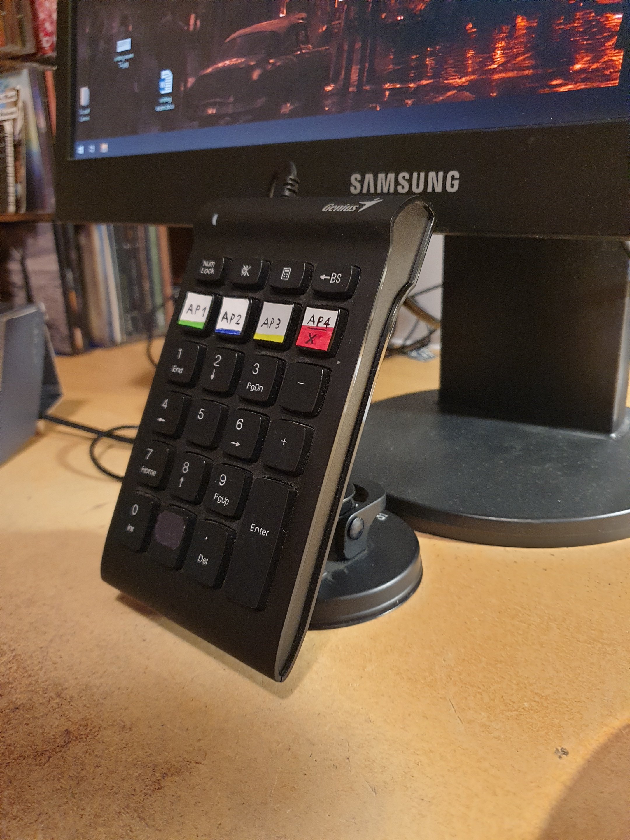
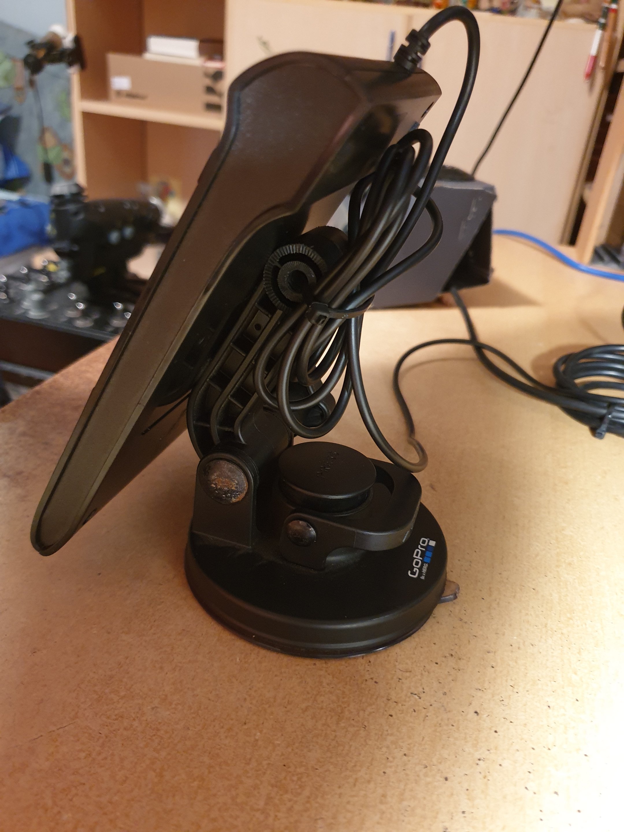
Numpad (10$)+ GoPro car suction cap mount (around $35 new). I bought this suction cap in a pawn shop for less (don't remember for how much, around $20), used it once and never again. I simply superglued the back of the numpad to it without any preparation. It's sturdy and the GoPro mount is for real (they put these on airplanes and sports cars and whatnot).
-
4
-
-
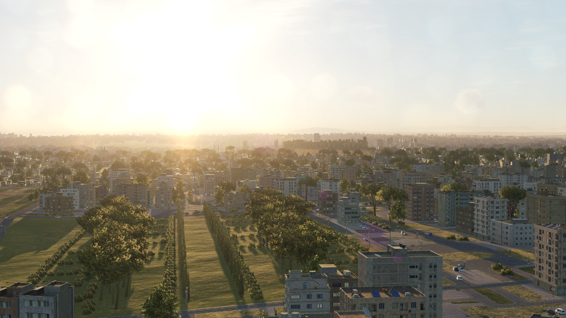
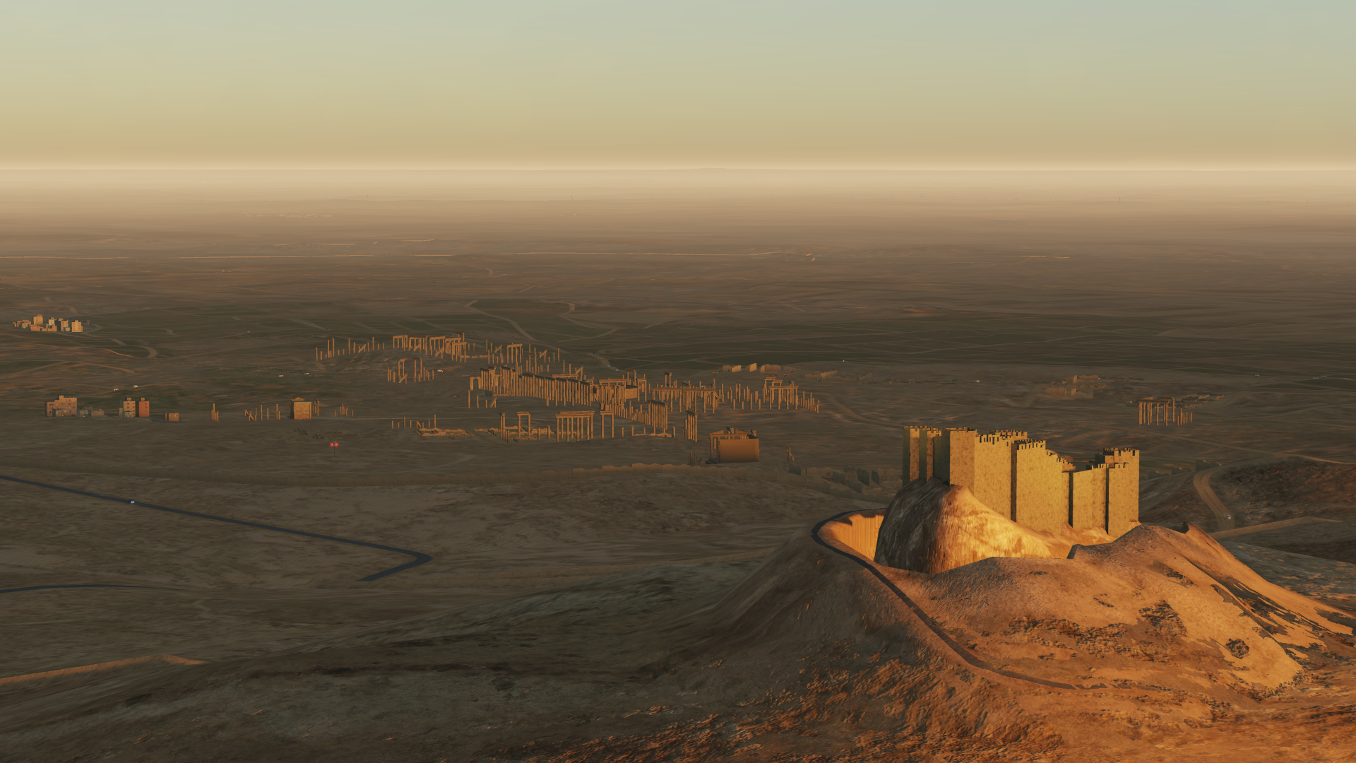
Today marks ten years since the Syrian conflict "officially" started, even though the actual civil war is considered to have started in late 2011.
Here's hoping that this wonderful country with a stunning history and lovely people finds peace and normality some day, and that all the extremists, terrorists, dictators, and psychopaths in suits from all the opposing countries stoking the conflict to their own ends find a way out of real life and into DCS World with us, and that they don't forget to share their geographic coordinates.
Here's an Aleppo skyline without the Umayyad Mosque's minaret (because it doesn't exist anymore), and a Palmyra without the Temple of Bel (because it doesn't exist anymore).
-
 1
1
-
-
How does hovering the Harrier compare to a chopper in difficulty?


DCS Screenshot and Video thread
in DCS Series
Posted
I take after imperial shuttles.